12/29/2009

Annapurna Circuit Day 15: I fought Nepal and Nepal won

One reason I decided to part ways with my hiking partners was because I wanted to do a side hike to the village of Lupra. In that tiny village, tucked away in a narrow side canyon, are two working monasteries of the Bon religion. It is the earliest surviving Bon community in Nepal and the only village of the faith in the Mustang region.

Bon predates Buddhism by hundreds or even thousands of years. The Buddha was born in Nepal about 500 years before Christ was born. I wanted to see a working place of worship for a religion which predated Christianity by centuries.

That's right, it's yet another thing that may interest only me!

I started south from Kagbeni. Immediately I got stuck in the morning rush hour.

I continued through the small village of Eklhaibhatti, crazily located in the Kali Gandaki river bed.

There are a couple stone walls to divert high water, but this place strikes me as a minor disaster waiting to happen.

I posted a picture of the YacDonald's in Kagbeni in a previous post. I thought it fitting that a restaurant which blatantly rips off an American corporate icon is also the only one I saw that advertised on the trail.

Then I made a left up the narrow Panda Valley. The walk was miserable. There wasn't a trail. It was a river bed literally covered with smooth rocks, most the size of bowling balls. It only took about an hour to get from the main trail to the village but it was tiring and hard on my ankles.

The sun was rising just behind the village which made getting a photo next to impossible for a pointer-and-clicker like me. This shot gives an idea of the treacherous walking conditions, as well as how tiny the village is.


This tiny enclave of 16 homes has managed to keep alive a religion that has disappeared or been absorbed by Buddhism virtually everywhere else.

I had seen signs of the religion in Kagbeni. There were fetishes above doorways.


Just outside the gompa in Kagbeni is a carved human figurine embedded in a wall.


As I noted in a previous post the swastika, long before it became known in the western world as a symbol of Nazism, was a Buddhist and Hindu symbol. It was also a Bon symbol. With a slight twist. Literally.

I saw this on the prayer wall at the gompa in Kagbeni.


The swastika at the bottom "turns" to the right as it does in Buddhism (and Nazism). The one at the top, however, turns to the left, as in Bon. It was the only Bon swastika I saw there. I asked a young monk why this one particular swastika was different from the rest. He didn't know about it! It really is something that interests only me!

The stupa at the entrance to Lupra is unlike any I've seen in Nepal, or anywhere else for that matter.

I could tell by the way people stopped and stared the village doesn't get a lot of tourists. I asked where the gompa was. Of course it was at the top of the hill.

When I got there it was closed. Word had gotten around so soon a woman came to unlock it for me.

I wasn't allowed to take pictures, which wasn't a big deal, as it turned out. I have to admit I was disappointed. To my admittedly untrained Western eyes the Bon temple, called Yungdrung Phuntshakling, was virtually indistinguishable from a Buddhist temple. It's not surprising, considering Buddhism more or less absorbed Bon. The two religions have co-existed for thousands of years. My side trip sounded a lot more interesting on paper than it actually was.

I headed back down the boulder-strewn valley and headed towards Jomsom, the main hub of the western leg of the Annapurna Circuit. I was hiking down the Kali Gandaki river valley. I saw children playing and families picnicking in the riverbed. I have no idea why or where they came from.

Jomsom sits in the distance, with Dhaulagiri, the seventh-highest mountain in the world, looming overhead. Off camera to the left is Annapurna, the 10th-highest. Because the river runs between these two peaks this valley is considered to be the deepest in the world.

As I walked I was debating what to do. I wasn't sure I wanted to continue hiking on the trail. On this side of the circuit the trail is an actual road. I was constantly having to step out of the way of vans, jeeps and motorcycles. It really sucked the romance out of an otherwise perfect day for hiking.

I saw very few hikers. Most people were in a vehicle or on mountain bikes or, like these folks, on horseback.


I was feeling strong and fresh for the first time in days. Why not keep walking?

Then again, I could also avoid a lot of the road traffic by taking a bus from Jomsom to Tatopani and then continuing on foot. Maybe I could visit Annapurna Base Camp again? Or maybe not. The trail out of Tatopani ascends a sadistic 1,900 meters, the longest climb on the Annapurna Circuit. That's nearly a mile and a quarter of vertical distance, not walking distance.

I was hiking on the flattest, widest section of trail I had ever seen in Nepal, which made what happened next all the more bizarre. One second was cruising along. Then I was lying face down in the dirt with a badly sprained ankle.

I have no idea what happened. I completely wiped out. My guess is that all the boulder hopping in the morning had weakened my ankles. Whatever the reason, I could barely put any weight on my left foot.

Here is a picture of my ankle.


I sprained it on October 30. This picture was taken on December 27. It's still swollen two months later. Luckily I had my trusty hiking pole to lean on. Even more luckily my next stop was a village with an airport.

All things considered I was incredibly fortunate the mishap occurred where it did, which was right about here.

I didn't have far to walk. I hobbled into Jomsom, found the first available hotel room, booked a flight out for the next morning, and took a few obligatory photos before hopping into bed to rest my ankle.

Jomsom is a soulless place. I didn't mind that it's "modern". It just has no personality.


It does have, however, perhaps the best setting for an airport in the world.


I hope the guy who painted this advertisement for rock climbing was paid well.


If I had been in a village I liked, such as Manang or Kagbeni, I might have rested for a few days and continued hiking. I had no desire to stay in Jomsom.

I was glad I decided to leave when I checked out in the morning. I had spent two weeks sleeping in lodges owned by the most gracious and welcoming people. The owner of my hotel in Jomsom tried to overcharge me for my room, even though the prices are printed in the menu.

I had seen everything I wanted to see on the trail. I had been trying to convince myself to hike the entire circuit, just to say I had done it, but I wasn't at all enthusiastic about dodging traffic for the next few days. I had already been to Annapurna Base Camp. I don't feel like I missed out on anything. I was as content as I could be with a sprained ankle.

12/28/2009

Annapurna Circuit Day 14: Mustang sally

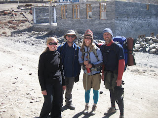
I wanted to spend another day exploring Kagbeni and the surrounding area, but my friends wanted to move on. The morning got off to a sad start as we said goodbye. From right to left: Kasia, yours truly, Tom, Rob and Josh.

They headed south. I headed north.

I wanted to visit Tiri, the only village in the Upper Mustang region tourists are allowed to visit without a permit. You can visit the region if you want, but it will cost you. A hiking permit for the Annapurna region costs 2000 rupees, about $25. A permit for the Upper Mustang region costs $700 for 10 days and additional $70 per day after that.

The similarity of the name of that to that of the horse (and the car) is purely coincidental. The horse gets its name from the Spanish. The place name is a corruption of a Tibetan name. Upper Mustang was formerly the independent Kingdom of Lo Monthang.

In 1960 the borders of Lo Monthang were closed. Foreigners were not allowed until 1991. There are no more kings or kingdoms in Nepal, however. The Kingdom of Lo Monthang officially ceased to exit on October 7, 2008.

From Kagbeni I had to cross the Kali Gandaki river bed and head north. There was some sort of festival going on. Locals were stringing flowers across the river. Nepalese love festivals. I had been hiking for less than two weeks and I had already seen three.


I was a little surprised to note this was a Hindu festival. Nepal is a primarily Hindu country. However, in terms of culture, language and religion, Mustang is more Tibetan than Nepali, for reasons that are obvious from this map.

Upper Mustang looks like it was carved out of Tibet. The people of the region are primarily Buddhist. However, as I'd seen repeatedly throughout Nepal, the cultures and traditions of Buddhists and Hindus are closely intertwined.

This is the view of Kagbeni from the other side of the river. The red gompa is the most prominent feature. Nilgiri towers in the distance.

There were disconcerting signs of civilization, like these power lines that hung so low over the trail I had to duck to get past them.


At the bottom of this photo is the existing path, with a reminder of the Sisyphean road building looming above.

I passed all this quickly. And then I had Mustang to myself. It was one of the best day hikes I've ever done. Sometimes I thought it would have been nice if my friends had been there to see it. Other times I was happy for the solitude. Every once in a while I would see or hear a jeep in the distance. Aside from that it the silence was nearly complete. Bliss.

The landscape is evocative of the American West, as is the name Mustang. A pair of horsemen trotting up the river valley added to the similitude.


I walked through Tiri without seeing a single person. The silence was eerie. I ascended the ridge behind the village. And then I just sat there and took it all in.

That's Tiri in the foreground. Thorung La is visible in the distance. I used the camera timer to take this self portrait looking north into Upper Mustang.


I thought I was alone, but I wasn't. I was being watched. There was a single horse silhouetted against the blue sky near the top of the bump in the ridgeline.


I had been incredibly fortunate with the weather. I went days without seeing a single cloud. Some clouds appeared on this day, but they actually enhanced the view. I had never seen clouds quite like these. It looked like someone had used a sponge to blot the sky with white paint.

I could have sat there all day.

At this time of year the Kali Gandaki river isn't really a river this far north. It's a series of streams that eventually meet further downstream. I had the brilliant idea of walking across the river bed. The streams were wider and deeper than I thought...

It wasn't so bad. I had to wade through a couple nearly knee-deep streams that were nearly. It was worth getting a little wet to get some really cool pix, like this one looking north towards Tiri.


This self-portrait is looking south towards Kagbeni.

I loved the crazy cloudscapes that day.

I wanted to visit the gompa during the afternoon to take some photos, so I reluctantly headed back to the lodge to change into dry clothes. As I was wandering through the labyrinthine streets I made a new friend.

This is the exterior of the gompa.

The overhang visible on the left is part of the monks' quarters. A wall of prayer wheels goes nearly the entire way around the outside of the building. Walk down the corridor, turn the corner, and there's the valley.

Young monks were playing in the courtyard. Boys will be boys, even in a Buddhist monastery.


The monks were kind enough to let me take photos inside. Here's a wall painting of the Buddhist Wheel of Life. The amount of detail is amazing. Every tiny piece has a meaning. Please don't ask me what those meanings are. Just enjoy the pretty colors like I do.

It was an exhilarating day.


12/27/2009

Annapurna Circuit Day 13: Fugitives in a forbidden land

We departed Muktinath with a new member of our fellowship, an Aussie named Josh. We arrived in Kagbeni after one of the best days of hiking any of us had ever done. We had the trail to ourselves for hours at a time.

The main path to Kagbeni runs through the village of Jharkot. We decided to cross the valley into Dzong and head down from there. We had a hard time just getting to Dzong. We had to wind through the back alleys of Ranipauwa and ask for directions several times. We still didn't find the best path.


The name of the village is transliterated as Dzong or Jhong and simply means 'fort'. From this viewpoint it's obvious why.


The remains of the actual fort, a sand-colored tower, are visible on the right of the plateau. It's called Rab-rgyal-rse, which translates to the rather florid "Peak of Supreme Victory". Next to it is is a guesthouse where we stopped for tea. The view looking back towards Muktinath and Thorung La was awesome, but I couldn't get a decent photo looking into the fierce morning sunlight. You'll have to go and see for yourself.

We saw two tourists in Dzong. Then we hit the trail. From that point on we literally saw one person until we arrived in Kagbeni -- a farmer plowing a field with a buffalo in the valley below. On the other side of the valley, on the main road through Jharkot, we saw a steady stream of jeeps and minivans. We chose our path wisely.

As magnificent as the scenery is in Nepal it is often lacking in color, which makes the view looking back to Dzong and Thorung La all the more startling.

From this vantage point it is obvious why Tibetan traders from centuries past chose Thorung La as a mountain pass. It doesn't look so high from here...

Popular souvenirs on this part of the trail are fossilized sea critters called ammonites. You can buy them or you can find your own. We found dozens. Most are smaller than a plum, but Kasia found this monster.


If you want it you can probably still find it on the trail. She and Rob had another two weeks of hiking so it didn't make sense to add a giant rock to her pack.

We were hiking at an altitude of nearly 10,000 feet, within sight of mountains nearly three times that high, and yet we were finding remains of critters that lived on the sea floor. The extreme terrain of the Himalayas forces you to rethink your conception of space and distance. These fossils forced me to rethink my conception of time. My mind clanked to a screeching halt as I tried to process the knowledge that these animals lived before the Himalayas even started to form, when the land I was walking on was at the bottom of an ocean.

Part of the appeal of the Annapurna Circuit is the chance to hike in the Tibetan Plateau, the world's highest desert. It's a stark landscape unlike anything I had seen in Nepal. Here are my hiking homeys on the way to Kagbeni.


We finally arrived at the river valley and this mind-boggling view.


The village is not our intended destination of Kagbeni. It's Tiri, the only village in the Upper Mustang region that tourists are allowed to visit without a permit. The region is restricted, which meant we were probably breaking the law!

Granted, this is Nepal. Here they would point wayward hikers in the right direction with a friendly smile, not throw them in a rat-infested hole and start lopping off body parts. Still, I did experience a mild frisson knowing I was doing something illegal.

Or maybe it was the wind making me shiver. We were standing above the deepest river valley in the world, a natural wind tunnel. The wind was blowing so hard on the ridge we had to lean into it to walk.

Kagbeni was just behind us.


The peak of Nilgiri, over 7,000 meters high, dominates the landscape. As we entered town on the road at the bottom of the picture we passed a sign informing us of our transgression.

I loved the village. Most villages on the trail crowd around the main path, but Kagbeni is a maze of back alleys that were fun to explore.

The most prominent building in town is the red, cube-shaped Thupten Samphel Ling gompa. This combination monastery, fort and university was built in 1429. Kasia went to check it out that afternoon. I love the cozy feel of Buddhist temples.


At sunset monks go onto the roof to play music.


The gompa is the main attraction in town, but every tourist who passes through gets a photo of this place as well.


Hilarious. Even though McDonald's is everywhere, this restaurant is so remote that apparently it's not worth it for their lawyers to shut it down. There was a constant stream of tourists taking photos but I never saw anyone inside!

We didn't eat there because we ate all our meals at our lodge. More on that in a separate post.

After Kagbeni the itineraries of my friends diverged from mine, so we enjoyed one last meal at the lodge that night. I normally don't drink on the trail, but this was a bit of an occasion, so I bought a small bottle of Mustang apple brandy, which was surprisingly palatable. When that was gone Rob broke out a his "medicine", a bottle of mint vodka. Good times.

12/24/2009

Chúc Mừng Giáng Sinh

Merry Christmas from Vietnam!

I'm in Saigon. It's the first time I've been away from home for Christmas. Yeah, it kinda sucks. This is the choice I made. I knew what to expect when I made the decision to not go home for the holidays.

It's not such a big deal because around here it's pretty much business as usual. It is winter here, however, as the locals keep reminding me. I've had people in Cambodia and Vietnam tell me how cold it is now. I had coffee with a friend at a sidewalk cafe in Saigon. She wanted to sit in the sun because she didn't want to get cold. It was 84 degrees...

I'm laying low today, resting my aching back and reading the new Dan Brown novel. I bought a photocopied version for $3. Merry Christmas to me.

One remnant of the French occupation of Vietnam is a sizeable Catholic population. The CIA website says 6.7 percent of the population is Catholic, although I've heard figures as high as 15 percent. The vast majority of the country is Buddhist like the rest of Southeast Asia.

Even so, they love Christmas!

I always thought it was absurd the way the C-word became taboo, the way Americans began to say "happy holidays" or "season's greetings" rather than -- gasp! -- offend someone by saying "Merry Christmas".

I am by no means a Bible thumper or even a practicing Christian, but I do know a little about American history. The United States was founded as a Christian nation. Anyone who says otherwise is misinformed or engaging in willful ignorance. I love having this debate so bring it on!

I've spent some time outside the country and I can safely say the world loves Christmas. I was in a mall in Bangkok in the first week of November. Some stores already had Christmas decorations up. Starbucks, of course, looked like Santa's workshop.

I knew Thailand was overwhelmingly Buddhist but I had no idea how much so until I went online. According to the CIA website the Christian population of Thailand is .7 percent. Less than one percent! People are crazy about Christmas even in a country where there are no Christians!

When I was in Phnom Penh there was a story in a local newspaper about:
A) How much Cambodians love Christmas
B) How little they know about it

My favorite quote was from a young girl who thought that Santa was the father of Jesus.

Merry Christmas!

Annapurna Circuit Day 12: Muktinath, miracles and Mona Lisa

We had arrived in Muktinath around 4:30 p.m. and set Kasia off to find us rooms. We tried the guest houses recommended by the travel books but those had been booked for hours. We ended up staying at the first place we found with rooms available.

The Mona Lisa guesthouse was nondescript but the food was outstanding. One member of our group, Tom, is a chef, and was genuinely impressed with the food quality. Most lodges provide good food and passable versions of various national cuisines. Every once in a while, though, you get lucky and stumble into a place like this where they take pride in their food.

There's a small prep area behind the wall on the right but all the food is cooked on this little stove.


Posters of the da Vinci masterpiece covered the walls. I'm no art expert, so I wasn't able to determine which was the original and which were copies. We were more fascinated by the poster on the wall outside my room.


It says:
We have been let us say, to hear the latest pole.
Transmit the Preludes, through his hair and fingertips.


When I read that I think ... I think ... I think what the heck does that mean? It's even funnier when you look closely at the photo. It appears to be the parking lot of a hotel. It was hilarious how many people stood and stared at the poster, trying to figure it out.

I needed a rest day to give my aching back and feet a break. It was a great place to do nothing. Officially and politically we were still in Nepal, but geographically, linguistically, culturally and ethnically we were in Tibet.

The setting wasn't quite as spectacular as Manang's, but it wasn't bad. Look back at the temple complex and the mountain pass.


Look across the valley at the village of Dzong, which I would walk through the next day.


Look down into the deepest river valley in the world.


Look up at Annapurna, the 10th-highest mountain in the world. (The hospital in the foreground is a reminder that since Muktinath is at the bottom of a mountain pass altitude sickness is a common problem here.)


The numbers of these photos on my memory card are 1044, 1045, 1046 and 1050. They're almost in sequence. You can stand in one spot, turn in a circle, and see all these sights. Incredible.

The village itself was a little shabby and dirty, sad to say. What was especially jarring was the sound of motorbikes. From Muktinath it is possible to travel by road all the way down the trail. I am happy the people in these remote mountain regions have access to modern conveniences. I would never begrudge people the chance to have electricity or celphones or motorcycles.

Having said that...

I don't want to hike in those places.

I don't hike in Nepal to be woken up at 6 a.m. by some knucklehead teenager revving his motorbike in the street outside my window for 20 minutes for no apparent reason.

Here's a funny street scene that illustrates the collision between the traditional and the modern. This was taken from the roof deck of my guesthouse. Power wires hang across the street. In the foreground is a small souvenir stand. In the background is a shop with an internet cafe above. In between is a woman milking a cow in the street.


I took it easy for most of the day, but I did walk up and explore the temple complex. Nepal is primarily a Hindu country. The temple is the second-most holy site for Nepal's Hindus. Inside the walls are both Hindu and Buddhist temples.

There weren't many tourists there when I was there, so I was able to enjoy the solitude of the winding, tree-lined paths as monks, like the one sitting in the shade of the tree on the right, went about their work.


The small Jwala Wai temple is home to a miracle.


Photos are not allowed inside the temple so I'll have to rely on my keen powers of observation and description. Ready? Here we go...

It's a flame on water.

Underneath the altar is a pool of water on which dances a blue flame. It's burned continuously for centuries. It's behind a small grate, which the nuns will open for a small donation. There were no nuns there when I was there, but I was able to view the flame through the mesh. (I still left a donation.)

Hindus view it as a miracle. One hiker I spoke to in town said he thought it was a bit foolish for the people of Nepal to journey all the way to the temple to view what was clearly just a jet of natural gas.

I thought, but didn't say, it was a bit foolish for someone from a primarily Catholic country to travel all the way to the temple just to disparage someone else's religious beliefs.

I met a Hindu priest or sadhu, from India. He was wearing bright orange robes and had a wild, unkempt beard. I desperately wanted to take his picture, and I'm sure he would have let me, but somehow I didn't feel comfortable asking.

He pointed out the cave on the mountainside where he sleeps.


It's the dark smudge smack bang in the center of the photo, sort of cradled between two of the red tree limbs. Annapurna is visible in the distance on the left. Dhaulagiri is wreathed in clouds on the right.

He shares the cave with the temple's Buddhist lama. The sadhu said he's been caring for the lama, who has been too ill to leave the cave. We westerners can certainly learn from the peaceful and easy co-existence of the various eastern religions. There are lively debates about the various strains of Buddhism, for instance, but nobody gets killed because of it.

On the other hand, it was disappointing to see barbed wire topping the fences of the complex. I can't imagine what it was there for. A skilled photographer could probably make a striking image out of the juxtaposition of these two walls: the enclosing wall topped with barbed wire with its implied threat of violence and, just inside and running parallel, a Buddhist prayer wall with its overt message of peace and tolerance.


Just outside the wall is a helipad that was used by the royal family, when there was a royal family.


The next time someone wants to land they'll have to remove the prayer flags first. Just beyond the helipad the path into town is lined with souvenir stands. Here you can buy handmade wool scarves fresh off the loom.

I bought a couple scarves from this woman, whose name, to my ears, sounded like Bema Tomo. I walked a little ways and someone asked me how much I paid. She told me she'd sell me one cheaper. I didn't need one but the price was so cheap I couldn't say no. I walked a little further and someone asked me how much I paid...

I finally stopped after buying two scarves for 100 rupees each. That's a handmade wool scarf for about $1.25! I felt like I was stealing. I bought eight scarves for an average price of about $2. The next time I hike there I'm going to hire a porter just to carry trash bags full of scarves. I'm going to buy them all.

Back in town I was happy to learn that everyone we had met on the other side of the pass made it over safely. We did learn, however, that a hiker had died in Muktinath a few days earlier. A Korean girl made it over the pass but was suffering badly from altitude sickness when she arrived. One of the symptoms is loss of coordination. She apparently fell in the shower and hit her head.

All of the stories of trail mishaps have to be taken with a grain of salt, of course, since they are passed by word of mouth up and down the trail. It seems likely, though, that at least four people died on the trail while I was there.

Everyone in my group decided to rest in Muktinath for a day. Paul and Jane, a couple from Ashville, NC that I met in Chame decided to move on. Here they are on the right saying goodbye to Kasia and Rob. I would run into Paul and Jane a few days later in Pokhara.


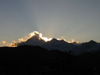
The sky was blessedly clear of clouds for virtually the entire time I hiked. My second night in Muktinath a wild bouquet of clouds clung to Dhaulagiri at sunset. The view was ... ok.